The largest of the Geiyo Islands on the Shimanami Kaido cycling route, home to Oyamazumi Shrine and several art museums.
- Best time
- Not added yet
- Parking
- 📍 Navigate in Google Maps ↗Nearby parking8 min walkℹ Paid · Fee not confirmed (check signs on arrival)📍 Navigate in Google Maps ↗Nearby parking10 min walk✓ Free parking🚗 All Nearby Parking & Real-Time Availability🔍 Find Nearby Parking on Map ↗
Before travel or when you arrive, check live space availability and confirmed rates via Google Maps.
- Getting there
- Plan the route from your start ↓ · Open in Google Maps ↗
- Official info
- Wikipedia ↗
Send this place via WhatsApp, X, Facebook, Line, or copy direct link.

📷 mukarin from Tokyo, Japan · CC BY-SA 2.0 · Source
Weather for your date
Today shows live hourly weather. Future dates show the best available report.
9°C
Clear sky
💧 0% rain chance · wind 15 km/h
Hourly forecast
Forecast: Open-Meteo
Getting to Omishima Island
🚉Tadanoumi Station
Approx. 10.4 km from spot
🚌Local Bus or Taxi
Bus ~15-25 min (¥210-¥350) / Taxi ~¥1,500-¥3,000
💳Mobile Suica / IC Cards
IC cards accepted on most local buses
Directions to Omishima Island
Leave the start blank to choose your current location in Google Maps. The pin is an approximate landmark; check the entrance and live services in Maps.
When to see this place
Typical viewing windows. Weather and bloom dates vary each year; these are not live forecasts.
No month-specific guide yet for Nov. This does not mean the place is closed.
Suitability
Stroller: Not verified
Nursing room: Not available
Noise level: moderate
Rules
Drones: banned
Nearby places
Within 30 km, closest first.
 Ehime
Kirosan Observatory Park
Perched at the southern tip of Oshima along the Shimanami Kaido, this world-renowned modern observatory was designed by master architect Kengo Kuma. Buried beneath the mountain summit to protect natural scenery, its cantilevered viewing decks offer a dramatic 360-degree panorama over the Kurushima Kaikyo suspension bridge and islands.
 Ehime
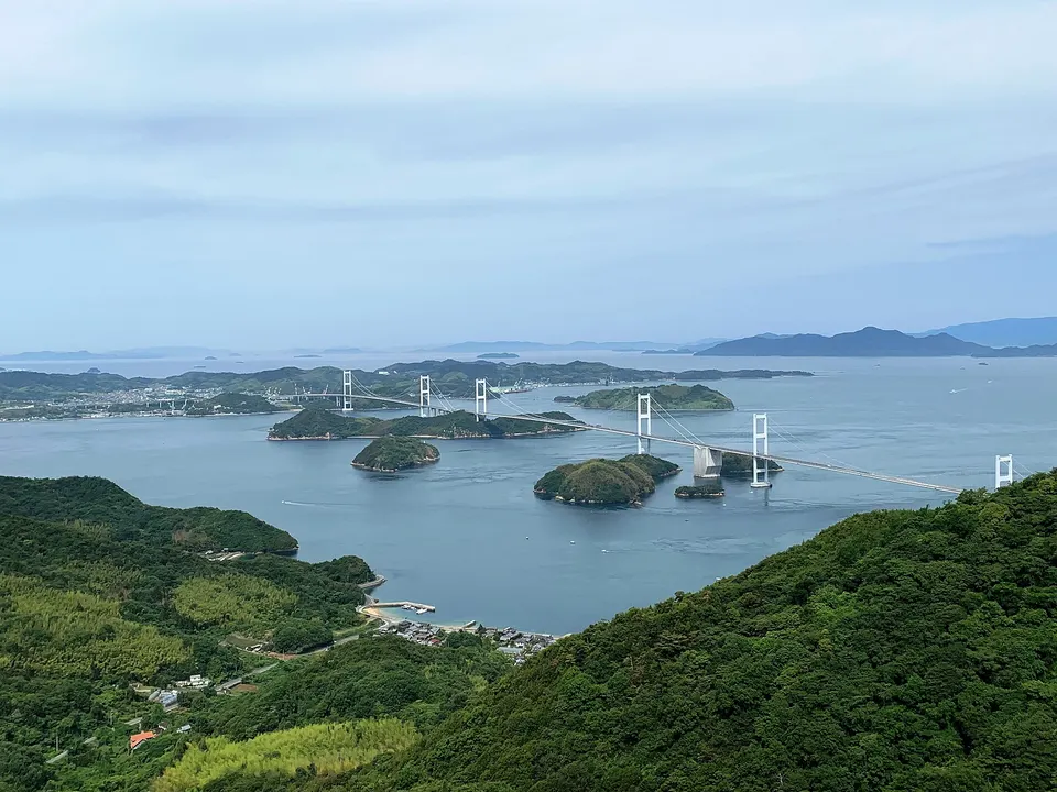
Kurushima Kaikyo Bridge
Three linked suspension bridges stretch 4,105 metres across the fast-moving Kurushima Strait at the Imabari end of the Shimanami Kaido. A separated cycling and walking route provides sweeping island and shipping views.
 Ehime
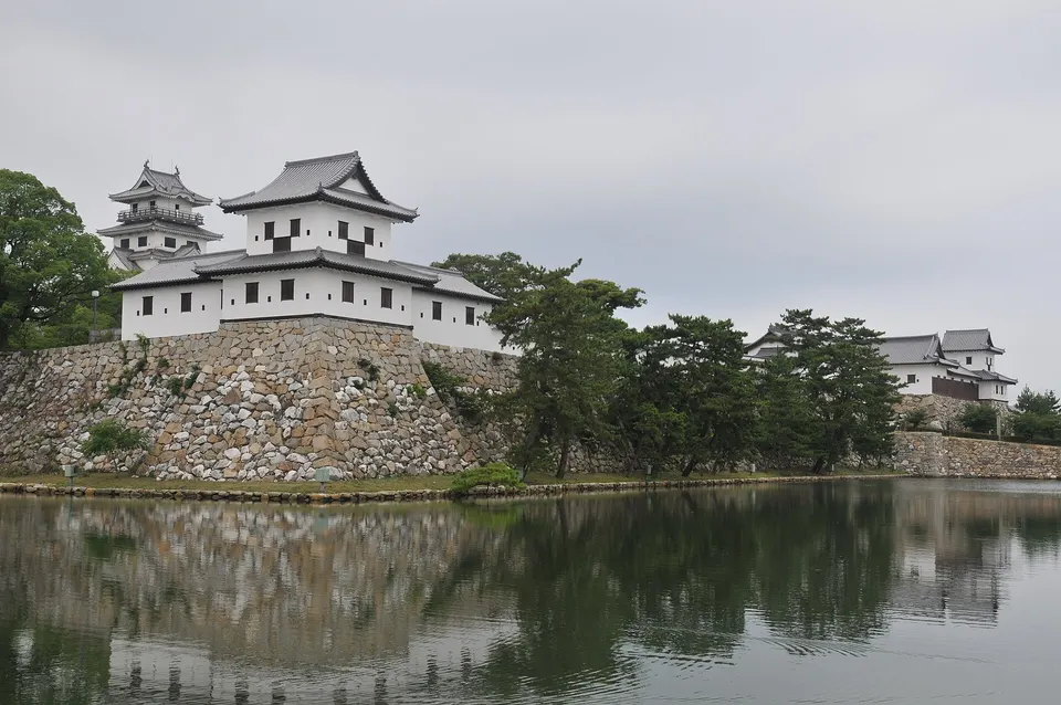
Imabari Castle
A reconstructed coastal castle notable for its broad seawater moat, stone walls and views toward the Seto Inland Sea. The illuminated keep and moat create a second experience after dark.
 Hiroshima
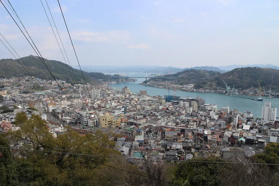
Senkoji Park and PEAK Observatory
A hillside park above Onomichi with a long observation deck over the channel, port town and Seto Inland Sea islands. The ropeway provides the easiest ascent, while temple lanes and the Path of Literature create a scenic descent.
 Hiroshima
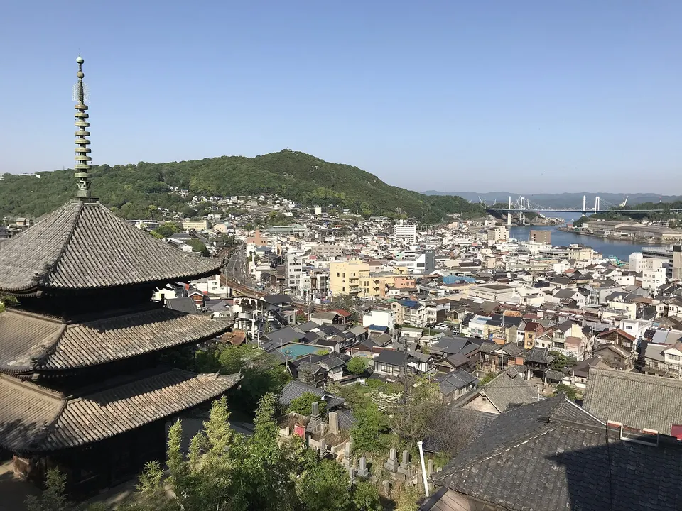
Tenneiji Pagoda and Onomichi Temple Walk
The three-storey pagoda of Tenneiji creates one of Onomichi’s defining hillside views, framed by tiled roofs, the channel and distant bridge. It sits along the broader temple-and-alley walking network.
Sources, photo credits and verification
Place information: Official tourism source · Reviewed 2026-10-06
- 1. Omishima Bridge in Ehime prefecture, Japan · mukarin from Tokyo, Japan · Source ↗ · CC BY-SA 2.0
- 2. Hakata Salt Mfg.Inc. Omishima Plant in Imabari, Ehime pref., Japan. · Hyougushi · Source ↗ · CC BY-SA 2.0
- 3. Emblem of Ōmishima, Ehime (1961–2005) · mti · Source ↗ · Public domain