Shizuoka

Koibito Misaki — Lovers Cape

Fuji Views

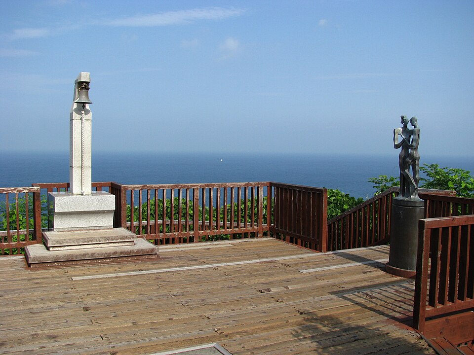
Izu City (伊豆市), Toi coast. A cape reached by a walking path and wooden deck, with views over Suruga Bay and toward Mount Fuji when weather allows. Allow time for the return walk.

Two Lovers Point in Izu-City 01.jpg
💡 Reference photograph, not a live view or a record of every month. Check the monthly planning notes and current access.
Two Lovers Point in Izu-City 01.jpgReference photo · selected conditions are not photographed yet

Capture month unconfirmed · Historical photo, not a live view

AUTUMN · Oct

JanFebMarAprMayJunJulAugSepOctNovDec

Weather for your date

Today shows live hourly weather. Future dates show the best available report.

☁️

21°C

Mainly clear

💧 0% rain chance · wind 16 km/h

Hourly forecast

☁️21°💧 0%
☁️21°💧 0%
☁️21°💧 1%
🌤️22°💧 2%
🌤️23°💧 2%
☁️23°💧 0%
🌤️24°💧 0%
🌤️25°💧 2%

Forecast: Open-Meteo

Packing checklist

  • Also useful: Rain layer and shoes with good grip, Water and sun protection, Warm outer layer

Parking

  • Nearby public parking (OpenStreetMap)

    NEARBY

    · 9 min walk

    Vehicle height not verified

    Community-mapped nearby parking. Capacity, fees, hours and vehicle limits are not verified; check signs on arrival.

    Parking source ↗

Directions to Koibito Misaki — Lovers Cape

Google Maps directions ↗

Leave the start blank to choose your current location in Google Maps. The pin is an approximate landmark; check the entrance and live services in Maps.

A DIFFERENT JAPAN, EVERY MONTH

When to see this place

Typical viewing windows. Weather and bloom dates vary each year; these are not live forecasts.

SEASONAL · DAY

October — cape and Suruga Bay outlook

Explore the cape and Suruga Bay outlook. Plan the return walk before sunset. This entry is general monthly planning guidance; it does not promise a special flower display, peak autumn color, or uninterrupted access. Check the official destination notices.

Tourism source ↗

Suitability

Stroller: Not verified

Nursing room: Not verified

Noise level: moderate

Kids: Steps and uneven paths may be present; supervise children near water and exposed edges.

Rules

Coordinates

34.8700, 138.7550

Open in Google Maps

Nearby places

Within 30 km, closest first.

Shizuoka

Toi Gold Mine

Izu City (伊豆市), Toi. Explore the history of gold mining through the visitor tunnel and exhibits. Activities and entry have separate operating conditions; check the operator for current hours and prices.

5 km away
Shizuoka

Joren Falls

Izu City (伊豆市), Amagi. A waterfall dropping from a basalt cliff into a wooded gorge. The approach includes steps; nearby wasabi cultivation reflects the clear mountain water.

15 km away
Shizuoka

Old Amagi Tunnel

Izu City / Kawazu boundary, Amagi Pass. A historic stone road tunnel associated with the old Amagi route and The Izu Dancer. Mountain approaches require checking road and trail conditions before travel.

17 km away
Shizuoka

Kawazu Seven Waterfalls

Kawazu Town, Izu Peninsula — outside Izu City. A walking route linking seven waterfalls, including Shokeidaru. Routes differ in length and difficulty; check which sections are currently accessible before attempting the full circuit.

18 km away
Shizuoka

Shuzenji Niji no Sato

A large landscaped visitor park in Izu City, with themed areas and Japanese garden scenery.

19 km away
Shizuoka

Shuzenji Bamboo Grove Path

Izu City (伊豆市), Shuzenji. A short bamboo-lined path beside the Katsura River in the hot-spring town. Look for the circular bamboo bench and connect the walk with the nearby bridges and temple district.

19 km away
Shizuoka

Shuzenji Temple and Onsen Town

Explore Shuzenji Temple and the surrounding hot-spring town in central Izu. Combine the temple precinct with the riverside district; nearby bamboo remains green while deciduous trees bring autumn color.

19 km away
Shizuoka

Miho no Matsubara

A coastal pine grove in Shimizu, Shizuoka City, associated with the Hagoromo legend and views toward Mount Fuji. The pine trees are evergreen; mountain visibility depends on weather.

25 km away
Sources, photo credits and verification

Place information: Official tourism source · Reviewed 2026-09-16