A celebrated gorge in Oita known for its dramatic volcanic rock spires, peaceful river walks, and autumn leaf scenery.
- Best time
- All year
- Admission
- ¥0
- Parking
- 📍 Navigate in Google Maps ↗青の洞門・耶馬渓公共駐車場 (Ao-no-Domon Public Lot)2 min walk· 80 spaces✓ Free parking🚗 All Nearby Parking & Real-Time Availability🔍 Find Nearby Parking on Map ↗
Before travel or when you arrive, check live space availability and confirmed rates via Google Maps.
- Getting there
- Plan the route from your start ↓ · Open in Google Maps ↗
- Official info
- Wikipedia ↗
Send this place via WhatsApp, X, Facebook, Line, or copy direct link.

Apr · 📷 そらみみ · CC BY-SA 4.0 · Source
Weather for your date
Today shows live hourly weather. Future dates show the best available report.
18°C
Overcast
💧 93% rain chance · wind 3 km/h
Hourly forecast
Forecast: Open-Meteo
Getting to Yabakei Gorge
🚉Bungo-Mori Station
Approx. 17.6 km from spot
🚗Car Rental / Rural Bus
Drive ~30+ min from station
💳Mobile Suica / IC Cards
IC cards accepted on most local buses
This spot is located ~17.6 km from the nearest train station. Rural bus departures may run only 1–3 times per day. Always check return bus timetables in advance, or consider renting a car.
Directions to Yabakei Gorge
Leave the start blank to choose your current location in Google Maps. The pin is an approximate landmark; check the entrance and live services in Maps.
When to see this place
Typical viewing windows. Weather and bloom dates vary each year; these are not live forecasts.
No month-specific guide yet for Oct. This does not mean the place is closed.
Suitability
Stroller: Not recommended
Nursing room: Not available
Noise level: quiet
Rules
Water access: river
Drones: permit required
Nearby places
Within 30 km, closest first.
 Oita
Nakatsu Castle
A castle by the sea at the mouth of the Yamakuni River in Nakatsu, counted among Japan's three great 'water castles', with a museum in the tower.
 Oita
Usa Jingu Shrine
The head shrine of the around 40,000 Hachiman shrines in Japan, a vast vermilion complex in Usa city.
 Oita
Yufuin Yunotsubo Street
A storybook boutique promenade lined with traditional Edo-style wooden shopfronts, artisan craft studios, roll cake cafes, and Yufuin cider stands. Stretching from JR Yufuin Station to Lake Kinrin, it frames spectacular vistas of the towering twin-peaked Mount Yufu volcano.
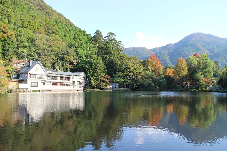 Oita
Lake Kinrin — Autumn Morning
A compact lakeside walk at Yufuin where autumn colour and cool-season morning mist create a distinctive late-autumn scene. Arrive early for a quieter circuit and check local conditions because mist is weather dependent.
Sources, photo credits and verification
Place information: Official tourism source · Reviewed 2026-10-25
- 1. Panorama of Mount Kyoshuho · そらみみ · Source ↗ · CC BY-SA 4.0
- 2. Panorama of Mount Kyoshuho from Rest House Domon · そらみみ · Source ↗ · CC BY-SA 4.0
- 3. Astragalus sinicus field and Mount Kyoshuho · そらみみ · Source ↗ · CC BY-SA 4.0
- 4. Mount Kyoshuho and Nemophila field 1 · そらみみ · Source ↗ · CC BY-SA 4.0
- 5. Mount Kyoshuho and Nemophila field 2 · そらみみ · Source ↗ · CC BY-SA 4.0
- 6. Mount Kyoshuho and Nemophila field 4 · そらみみ · Source ↗ · CC BY-SA 4.0
- 7. Mount Kyoshuho and Nemophila field 5 · そらみみ · Source ↗ · CC BY-SA 4.0
- 8. Mount Kyoshuho and Nemophila field 6 · そらみみ · Source ↗ · CC BY-SA 4.0
- 9. Mount Kyoshuho and Nemophila field 9 · そらみみ · Source ↗ · CC BY-SA 4.0
- 10. Mount Kyoshuho and statue of Zenkai · そらみみ · Source ↗ · CC BY-SA 4.0