A large island in the western Seto Inland Sea connected by bridge, known for mandarin oranges, quiet beaches and island scenery.
- Best time
- Not added yet
- Parking
- 📍 Navigate in Google Maps ↗Nearby parking7 min walkℹ Paid · Fee not confirmed (check signs on arrival)📍 Navigate in Google Maps ↗Nearby parking12 min walkℹ Paid · Fee not confirmed (check signs on arrival)🚗 All Nearby Parking & Real-Time Availability🔍 Find Nearby Parking on Map ↗
Before travel or when you arrive, check live space availability and confirmed rates via Google Maps.
- Getting there
- Plan the route from your start ↓ · Open in Google Maps ↗
- Official info
- Wikipedia ↗
Send this place via WhatsApp, X, Facebook, Line, or copy direct link.

📷 そらみみ · CC BY-SA 4.0 · Source
Weather for your date
Today shows live hourly weather. Future dates show the best available report.
5°C
Clear sky
💧 0% rain chance · wind 11 km/h
Hourly forecast
Forecast: Open-Meteo
Getting to Suo-Oshima Island
🚉Ōbatake Station
Approx. 9.4 km from spot
🚌Local Bus or Taxi
Bus ~15-25 min (¥210-¥350) / Taxi ~¥1,500-¥3,000
💳Mobile Suica / IC Cards
IC cards accepted on most local buses
Directions to Suo-Oshima Island
Leave the start blank to choose your current location in Google Maps. The pin is an approximate landmark; check the entrance and live services in Maps.
When to see this place
Typical viewing windows. Weather and bloom dates vary each year; these are not live forecasts.
No month-specific guide yet for Nov. This does not mean the place is closed.
Suitability
Stroller: Not verified
Nursing room: Not available
Noise level: moderate
Rules
Drones: banned
Nearby places
Within 30 km, closest first.
 Ehime
Aoshima (Cat Island)
A tiny island off Ozu reached by a small ferry, famous for having far more cats than residents; there are no shops or facilities.
 Yamaguchi
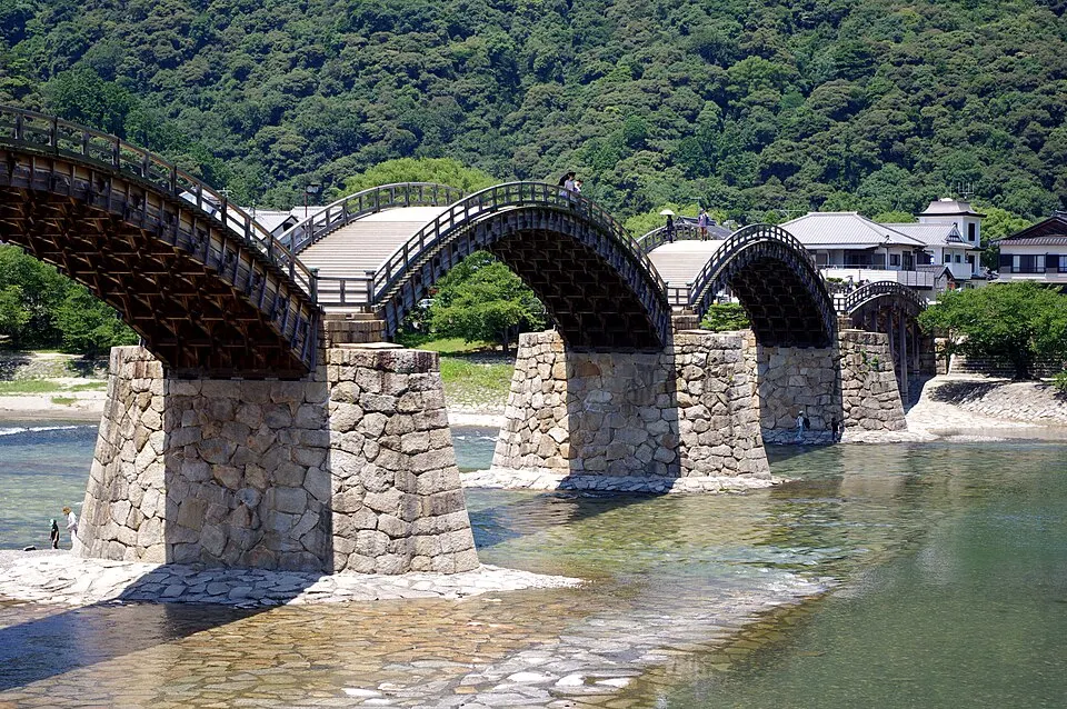
Kintaikyo Bridge
Five graceful wooden arches cross the Nishiki River beneath the hills of Iwakuni. The bridge has stepped sections. Check crossing arrangements and river conditions.
 Yamaguchi
Iwakuni Castle
A reconstructed castle tower on Mount Shiroyama above Iwakuni, reached by ropeway, overlooking the famous Kintaikyo arched bridge.
Sources, photo credits and verification
Place information: Official tourism source · Reviewed 2026-10-06
- 1. 山陽本線列車内より望む周防大島 · そらみみ · Source ↗ · CC BY-SA 4.0
- 2. Suo Oshima and Hokule'a · Waka moana · Source ↗ · CC BY-SA 4.0
- 3. 周防大島から浮島方面 · yuu.dash.ri3 · Source ↗ · CC BY-SA 3.0