Japan’s largest irrigation reservoir in Kagawa originally constructed in the 8th century by monk Kukai (Kobo Daishi).
- Best time
- All year
- Admission
- ¥0
- Parking
- 📍 Navigate in Google Maps ↗満濃池 ほたる見公園駐車場 (Manno Lake Hotaru Park Lot)2 min walk· 50 spaces✓ Free parking🚗 All Nearby Parking & Real-Time Availability🔍 Find Nearby Parking on Map ↗
Before travel or when you arrive, check live space availability and confirmed rates via Google Maps.
- Getting there
- Plan the route from your start ↓ · Open in Google Maps ↗
- Official info
- Wikipedia ↗
Send this place via WhatsApp, X, Facebook, Line, or copy direct link.

Weather for your date
Today shows live hourly weather. Future dates show the best available report.
20°C
Partly cloudy
💧 21% rain chance · wind 8 km/h
Hourly forecast
Forecast: Open-Meteo
Getting to Manno Lake
🚉Shioiri Station
Approx. 2.2 km from spot
🚌Local Bus or Taxi
Bus ~15-25 min (¥210-¥350) / Taxi ~¥1,500-¥3,000
💳Mobile Suica / IC Cards
IC cards accepted on most local buses
Directions to Manno Lake
Leave the start blank to choose your current location in Google Maps. The pin is an approximate landmark; check the entrance and live services in Maps.
When to see this place
Typical viewing windows. Weather and bloom dates vary each year; these are not live forecasts.
No month-specific guide yet for Oct. This does not mean the place is closed.
Suitability
Stroller: Accessible
Nursing room: Not available
Noise level: quiet
Rules
Water access: lake
Drones: permit required
Nearby places
Within 30 km, closest first.
 Kagawa
Nakano Udon School & Kotohira Promenade
Located at the foot of Kotohira Shrine's famous lantern-lined steps, this celebrated culinary institution offers a spirited hands-on workshop making authentic handmade Sanuki udon. Guests knead wheat dough with their feet to music, roll, cut, and eat their freshly cooked noodles, receiving an official graduation scroll.
 Kagawa
Kotohiragu Shrine (Konpira-san)
A famous shrine on Mount Zozu in Kotohira, reached by 785 stone steps to the main hall (1,368 to the inner shrine).
 Kagawa
Zentsuji Temple
Temple 75 of the Shikoku pilgrimage, built at the birthplace of Kobo Daishi (Kukai), with a five-storey pagoda.
 Kagawa
Mount Iino ('Sanuki Fuji')
A 422-metre cone-shaped hill between Marugame and Sakaide, nicknamed 'Sanuki Fuji', with an easy hiking trail.
 Kagawa
Marugame Castle
A castle with an original wooden keep and some of Japan's tallest stone walls, rising in tiers above Marugame city.
 Kagawa
Motoyamaji Temple
Temple 70 of the Shikoku pilgrimage in Mitoyo, whose main hall is a National Treasure, with a five-storey pagoda.
 Kagawa
Chichibugahama Beach
A long, flat beach in Mitoyo where shallow pools left at low tide mirror the sky, especially at sunset on calm days. Photos here are often compared to Bolivia’s salt flats. Check the tide time and sunset together.
 Kagawa
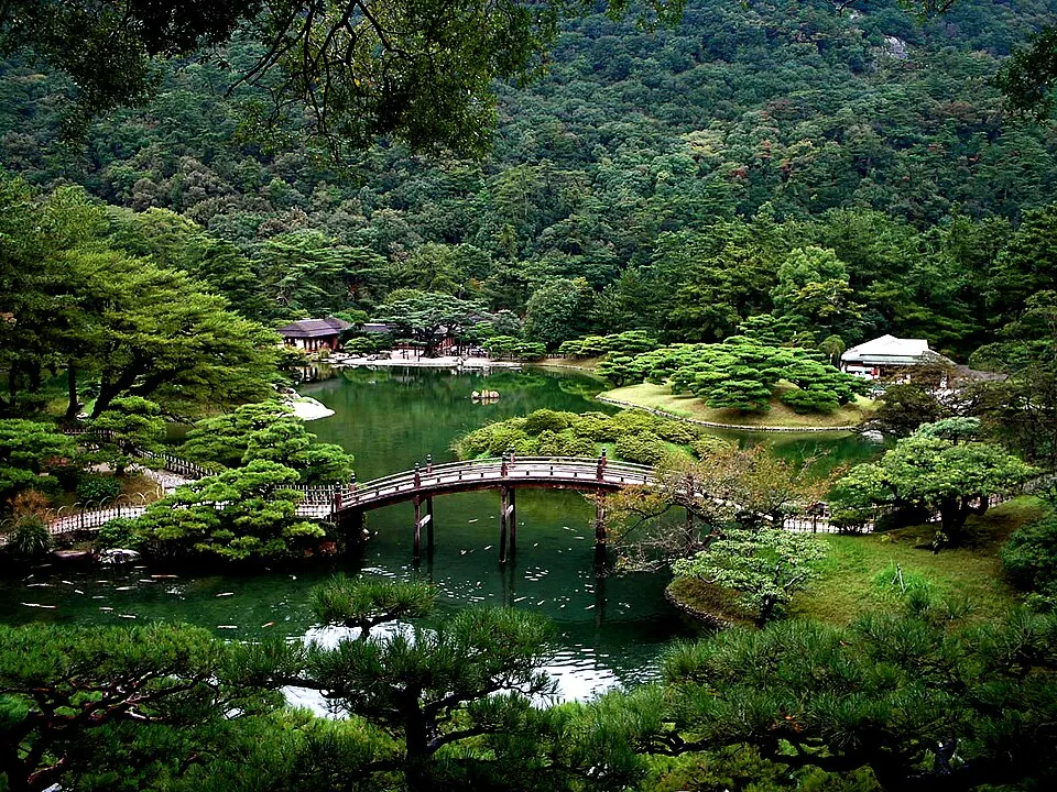
Ritsurin Garden
Takamatsu’s landscape garden combines ponds, sculpted pines and views of Mount Shiun. Allow time for a slow circuit. Boat rides, tea houses and evening openings have separate arrangements.
Sources, photo credits and verification
Place information: Official tourism source · Reviewed 2026-10-25
- 1. Mano Dam 06 · Σ64 · Source ↗ · CC BY 4.0
- 2. Mannolake11 · Nikkannie · Source ↗ · CC BY-SA 4.0
- 3. Mannolake13 · Nikkannie · Source ↗ · CC BY-SA 4.0
- 4. Mannolake14 · Nikkannie · Source ↗ · CC BY-SA 4.0
- 5. Daisenzan01a · Dokudami · Source ↗ · CC BY-SA 3.0
- 6. Mt. Daisen and Manno Lake · Miea.system · Source ↗ · CC BY-SA 4.0
- 7. Manno Lake and Cherry blossoms · Miea.system · Source ↗ · CC BY-SA 4.0
- 8. Mannolake1 · miea.system · Source ↗ · CC BY-SA 4.0
- 9. Mannoike from Kannoji · Reggaeman · Source ↗ · CC BY-SA 3.0
- 10. Mannolake10 · Nikkannie · Source ↗ · CC BY-SA 4.0