Late June–mid-October · Sightseeing water discharge
The powerful discharge is seasonal and can be cancelled by weather or water conditions; verify exact annual dates.
Tourism source ↗Japan’s tallest dam at 186 metres, reached as part of the Tateyama Kurobe Alpine Route. Observation decks reveal the immense arch structure, Lake Kurobe and seasonal sightseeing discharge. There is no direct private-car access.
Best time to visit: Oct–Nov – Alpine autumn and closing season · Apr–Jun – Snow-framed reservoir approach
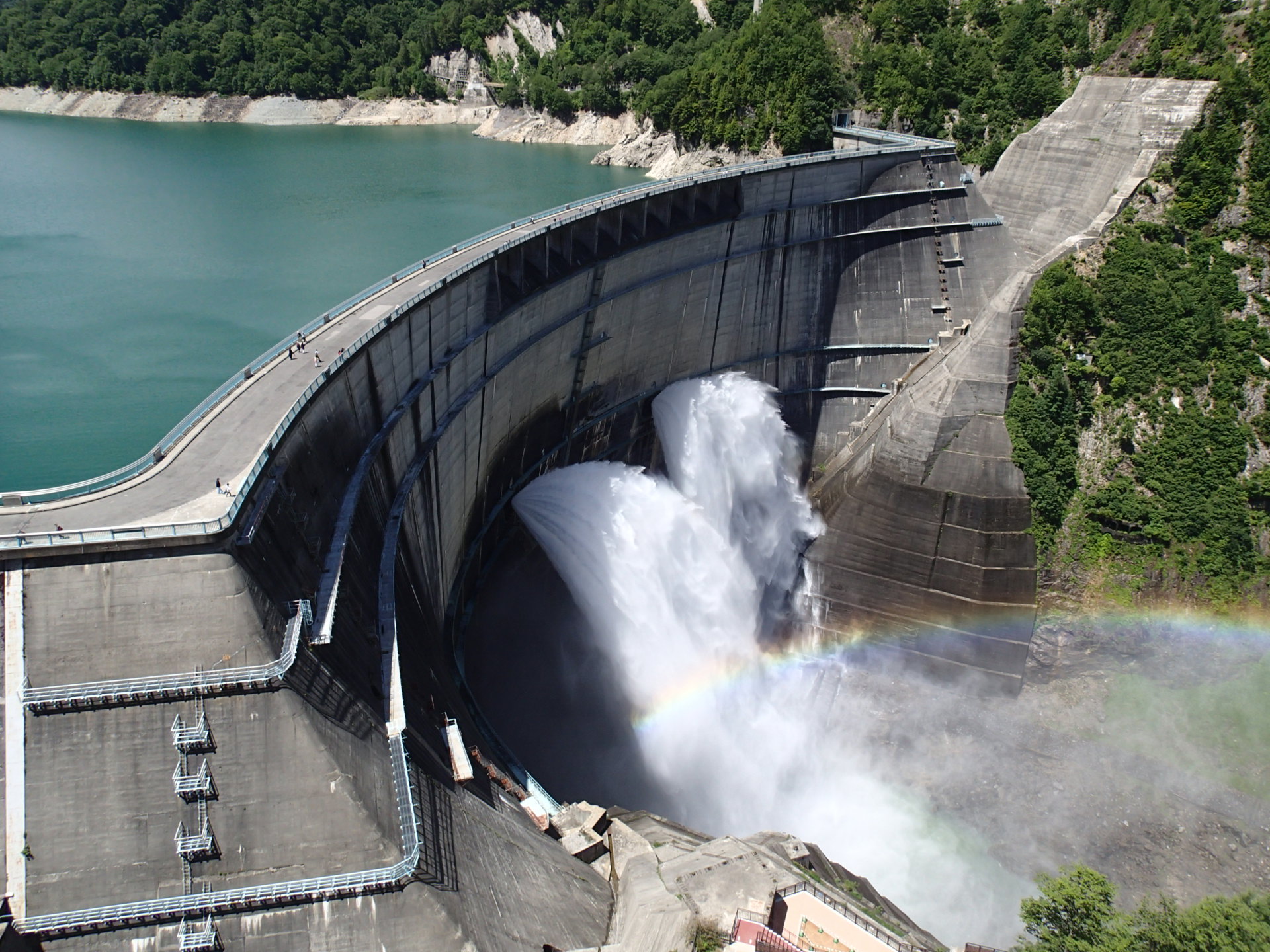
Recorded capture month: Jul · Historical photo, not a live view
AUTUMN · Oct
Weather for your date
Today shows live hourly weather. Future dates show the best available report.
10°C
Partly cloudy
💧 17% rain chance · wind 1 km/h
Hourly forecast
Forecast: Open-Meteo
Packing checklist
No tips added for this spot yet.
Parking
Parking has not been verified for this place.
Search nearby parking ↗Leave the start blank to choose your current location in Google Maps. The pin is an approximate landmark; check the entrance and live services in Maps.
A DIFFERENT JAPAN, EVERY MONTH
Typical viewing windows. Weather and bloom dates vary each year; these are not live forecasts.
The powerful discharge is seasonal and can be cancelled by weather or water conditions; verify exact annual dates.
Tourism source ↗Colour moves down the surrounding slopes before the winter closure.
Tourism source ↗Suitability
Stroller: Accessible
Nursing room: Not verified
Noise level: lively
Kids: Some viewpoints require long stair climbs; use signed step-free routes where available and protect children from cold and spray.
Rules
Fire: no fire
Water access: lake
Drones: banned
Within 30 km, closest first.
A roughly 90-kilometre mountain crossing through the Northern Alps using trains, cable cars, buses and ropeways. At Murodo, the spring Snow Wall walk passes between snow banks that can reach around 20 metres. Private cars cannot cross the route and winter closes the full connection.
The spear-shaped 3,180-metre peak of the Northern Japan Alps rises on the Nagano–Gifu border. The reference Yarisawa route from Kamikochi is a demanding multi-day alpine journey with mountain-hut stays and a steep final summit section.
A deep V-shaped gorge explored by the open-sided Kurobe Gorge trolley train from Unazuki. The line follows the river past bridges, cliffs, forests and secluded hot springs. It normally operates from late April into late November, with the reachable terminus depending on restoration and operating status.
Toyama’s largest hot-spring town and the gateway to Kurobe Gorge Railway. Clear mildly alkaline water feeds ryokan, a public bath and free footbaths, while compact streets offer mountain and river views.
Place information: Official tourism source · Reviewed 2026-09-28