October — Kotoku-in — Great Buddha of Kamakura
Use a light outer layer; autumn color may still be early at lower elevations.
Tourism source ↗An outdoor bronze Buddha at Kotoku-in, a heritage stop in the Hase area of Kamakura.
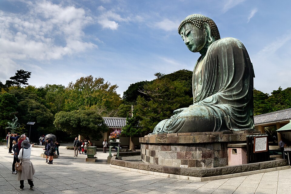
Capture month unconfirmed · Historical photo, not a live view
AUTUMN · Oct
Weather for your date
Today shows live hourly weather. Future dates show the best available report.
18°C
Mainly clear
💧 0% rain chance · wind 15 km/h
Hourly forecast
Forecast: Open-Meteo
Packing checklist
Parking
ダイレクトパーク鎌倉大仏横
NEARBY
· 2 min walk
Vehicle height not verified
Community-mapped nearby parking. Capacity, fees, hours and vehicle limits are not verified; check signs on arrival.
Parking source ↗Leave the start blank to choose your current location in Google Maps. The pin is an approximate landmark; check the entrance and live services in Maps.
A DIFFERENT JAPAN, EVERY MONTH
Typical viewing windows. Weather and bloom dates vary each year; these are not live forecasts.
Use a light outer layer; autumn color may still be early at lower elevations.
Tourism source ↗Suitability
Stroller: Not verified
Nursing room: Not verified
Noise level: moderate
Kids: Check the official accessibility guide for slopes, steps and child facilities.
Rules
Within 30 km, closest first.
Hasedera Temple, Kamakura in Kanagawa, prepared with map position, photo, accessibility notes and a month-based planning window.
A hillside temple with gardens and coastal views in western Kamakura. Expect stairs on the upper grounds.
Komachi-dori Street in Kanagawa, prepared with map position, photo, accessibility notes and a month-based planning window.
Tsurugaoka Hachimangu Shrine in Kanagawa, prepared with map position, photo, accessibility notes and a month-based planning window.
Hokokuji Temple Bamboo Garden in Kanagawa, prepared with map position, photo, accessibility notes and a month-based planning window.
A small island in Fujisawa reached by bridge, with Enoshima Shrine, the Sea Candle observation tower, Samuel Cocking Garden, Iwaya caves, coastal cliffs and sunset views toward Mount Fuji. It is often paired with Kamakura, but administratively belongs to Fujisawa, Kanagawa.
Hayama RV and Camping Area in Kanagawa, prepared with map position, photo, accessibility notes and a month-based planning window.
Nagai Seaside Park Soleil Hill Campsite in Kanagawa, prepared with map position, photo, accessibility notes and a month-based planning window.
Place information: Official tourism source · Reviewed 2026-09-20