A seasonal alpine driving route crossing Hachimantai, famous for spring snow walls, wetlands and autumn colour.
- Best time
- All year
- Parking
- 📍 Navigate in Google Maps ↗八幡平山頂P(有料)5 min walkℹ Paid · Fee not confirmed (check signs on arrival)📍 Navigate in Google Maps ↗八幡平山頂P(無料)8 min walk✓ Free parking🚗 All Nearby Parking & Real-Time Availability🔍 Find Nearby Parking on Map ↗
Before travel or when you arrive, check live space availability and confirmed rates via Google Maps.
- Getting there
- Plan the route from your start ↓ · Open in Google Maps ↗
- Official info
- japan.travel ↗
Send this place via WhatsApp, X, Facebook, Line, or copy direct link.

📷 Thyristorchopper · CC BY-SA 3.0 · Source
Weather for your date
Today shows live hourly weather. Future dates show the best available report.
-8°C
Overcast
💧 49% rain chance · wind 10 km/h
Hourly forecast
Forecast: Open-Meteo
Getting to Hachimantai Aspite Line
🚉Appi-Kōgen Station
Approx. 13.9 km from spot
🚗Car Rental / Rural Bus
Drive ~30+ min from station
💳Mobile Suica / IC Cards
IC cards accepted on most local buses
This spot is located ~13.9 km from the nearest train station. Rural bus departures may run only 1–3 times per day. Always check return bus timetables in advance, or consider renting a car.
Directions to Hachimantai Aspite Line
Leave the start blank to choose your current location in Google Maps. The pin is an approximate landmark; check the entrance and live services in Maps.
When to see this place
Typical viewing windows. Weather and bloom dates vary each year; these are not live forecasts.
No month-specific guide yet for Nov. This does not mean the place is closed.
Suitability
Stroller: Not recommended
Nursing room: Not available
Noise level: moderate
Kids: Terrain, steps, seasonal roads, weather and opening rules vary; check the official source before travel.
Rules
Fire: no fire
Drones: banned
Nearby places
Within 30 km, closest first.
 Iwate
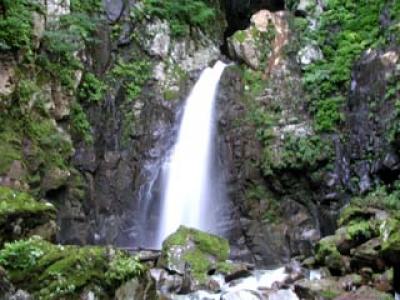
Chie Falls
A secluded waterfall in Hachimantai reached after a drive and roughly 30 minutes on foot. The falls drop about 15 metres into a cool forest gorge, with rough and steep footing near the riverbed.
 Akita
Mount Akita-Yakeyama
A small volcano in the Hachimantai area surrounded by steaming hot-spring fields such as Tamagawa and Goshogake.
 Akita
Tamagawa Onsen Nature Trail
A boardwalk through steaming volcanic ground at Tamagawa Onsen, Japan's most acidic hot spring, where visitors lie on warm rock beds.
 Iwate
Kakkonda Gorge
A roughly ten-kilometre gorge upstream on the Kakkonda River in Shizukuishi, surrounded by extensive beech forest. Fresh green foliage and autumn colour contrast with columnar-jointed cliffs and clear water.
 Akita
Mount Nyuto (Eboshidake)
A 1,478-metre peak on the Akita–Iwate border above Nyuto Onsen, with alpine meadows on the summit ridge.
 Iwate
Mount Iwate
Iwate's highest mountain at 2,038 metres, a volcano often called 'Nanbu Fuji' that dominates the view from Morioka.
 Iwate
Genbudo (Shizukuishi)
A cliff of columnar basalt along the Kakkonda River in Shizukuishi, a designated natural monument.
 Iwate
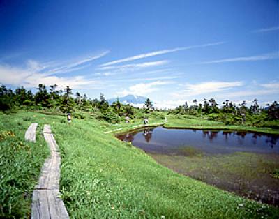
Senshogahara Wetland
A remote high moor in Towada-Hachimantai National Park with hundreds of small ponds and alpine plants. Reaching it requires a serious mountain hike of roughly three hours each way from common trailheads.
Sources, photo credits and verification
Place information: Official tourism source · Reviewed 2026-10-04
- 1. The Hachimantai Aspite Line, part of the Iwate Prefectural Road and Akita Prefectural Road Route 23, in Hachimantai National Park between Iwate and Akita Prefectures, North-eastern Honshu, Japan. Ex-toll road. · Thyristorchopper · Source ↗ · CC BY-SA 3.0
- 2. The Hachimantai Aspite Line. Hachimantai, Iwate, Japan. · Douglas Paul Perkins · Source ↗ · CC BY 4.0